Trip Facts
Country:
Manaslu Region, Nepal
Duration:
16 Days
Max Altitude:
5,106 m / 16,752 ft (Larke La)
Activities:
Trekking
Region:
Manaslu Conservation Area, Gorkha
Grade:
Strenuous
Group Size:
1–12 people
Accomodation:
3-star hotel in Kathmandu (2 nights), teahouse lodges on trek (13 nights)
Trips Overview
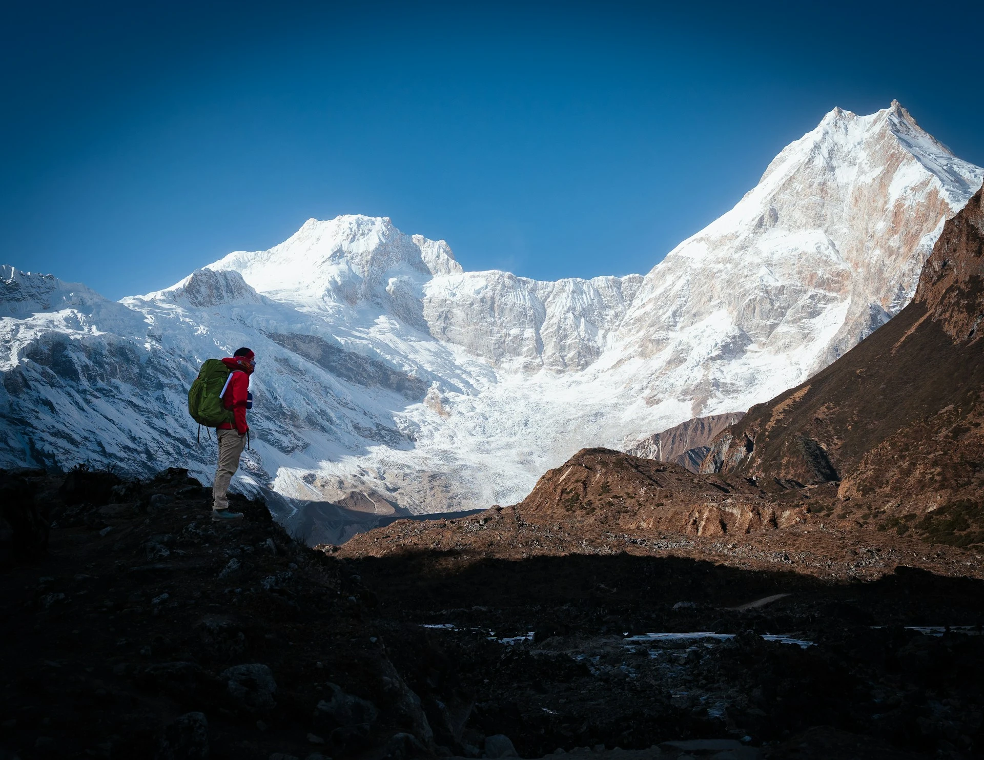
Manaslu is 8,163 m, the eighth highest mountain on earth, and this trek walks a full circle around it. You start at 869 m in a subtropical river gorge and finish 15 days later having crossed Larke La at 5,106 m. That is 4,237 m of net gain on foot, more vertical range than any other teahouse trek in Nepal.
People describe it as the Annapurna Circuit as it was 25 years ago. For once the comparison is fair, and there is a concrete reason for it: there is still no road along most of the route. The Budhi Gandaki gorge is too narrow and too steep to build one cheaply. So you walk on trail, not on a jeep track, for eleven of the thirteen trekking days.
What you actually get
Fewer people. In October the Annapurna Circuit puts several hundred trekkers a day over Thorong La. Larke La sees a fraction of that.
Real cultural change as you climb. The lower valley is Hindu Gurung and Magar country, rice terraces and buffalo. By Namrung at 2,630 m the names change, the roofs change, and by Samagaon at 3,530 m you are in a Tibetan Buddhist village whose people crossed the Rui La pass from Tibet within living memory. This is not a village dressed up for trekkers. It is a working yak-herding settlement at the head of a glacier.
And what you give up
Comfort. The lodges are more basic than anything on the Everest or Annapurna trails. Expect plywood partitions, shared squat toilets above Namrung, and no wifi you would trust. Only a handful of places have anything you could call a hot shower.
The first three days are hot. Machha Khola in late September sits in the high twenties, and the trail there is genuinely rough: landslide scars, suspension bridges, and sections cut into the rock face above the river. It is the part nobody photographs.
The restricted area, in plain terms
Manaslu is a government-restricted area. You cannot walk it independently and you cannot buy the permit yourself. A registered Nepali trekking agency has to apply on your behalf, and you must trek with a licensed guide. We hold the agency registration and we arrange all three permits. There is more detail in the permits section below, including what changed in March 2026, because most operator pages on this trek are still describing the old rules.
Trips Highlights
- Cross Larke La at 5,106 m, the highest point of the circuit and one of the longest single trekking days in Nepal
- Walk a full circle around Manaslu, 8,163 m, the eighth highest mountain in the world
- Two active acclimatisation days, at Samagaon (3,530 m) and Samdo (3,875 m), instead of the single day most itineraries allow
- Hike to Manaslu Base Camp at 4,800 m, or to Birendra Lake and Pungyen Gompa, on the Samagaon rest day
- Reach Samdo, the last permanent village on the route, four hours' walk below the Rui La crossing into Tibet
- Climb through 4,237 m of vertical range on foot, from a subtropical gorge at 869 m to the snowline
- Follow the Budhi Gandaki gorge, still roadless for most of its length, on trail rather than jeep track
- See the valley change from Hindu Gurung and Magar villages to Tibetan Buddhist yak-herding settlements above Namrung
- Visit the gompas at Lho, Samagaon and Pungyen, all working monasteries rather than trekking stops
- Finish down the Marsyangdi at Dharapani, where the Annapurna Circuit trail joins from the south
Trips Itinerary
We meet you at Tribhuvan International and drive you to the hotel. Nothing else is required of you today.
In the afternoon or the following morning, depending on your flight, your guide runs through the route, checks your kit and shows you the permits. Bring the passport you gave us the scan of. The restricted area permit is issued against that exact passport number, and a checkpost will not accept a different one.
Duration:
Transfer 30 to 60 mins
Accomodation:
3-star hotel, Kathmandu
A long day in a vehicle and there is no way around it. Tarmac to Dhading Besi, then rough road along the Budhi Gandaki through Arughat and Soti Khola.
The last two hours past Soti Khola are the worst of it: a single-lane track cut into the gorge wall, in a jeep, with the river a long way below. It is safe in dry conditions and the drivers do it daily, but it is not comfortable. If the road has been closed by a landslide we start walking from Soti Khola instead and make up the ground the following day.
You end at 869 m, the lowest point of the whole trip. Machha Khola means fish river, and it is warm enough here that you will sleep with the window open.
Duration:
8 to 9 hrs drive, 160 km
Accomodation:
Teahouse lodge, Machha Khola
The first walking day, and it is hot. In September and early October the gorge holds heat into the high twenties and there is little shade before Tatopani.
The trail crosses and recrosses the river on suspension bridges, climbs over rock spurs and drops back to the water each time. Net gain is only 471 m but you will do close to a thousand metres of up and down to get it. There are hot springs at Tatopani, worth twenty minutes.
Jagat is the restricted-area checkpost. Your guide hands over the permits and the police log your passport numbers. It takes twenty minutes and there is nothing for you to do but wait. From here on, walking without a guide is not legal.
Duration:
6 to 7 hrs trek, 22 km
Accomodation:
Teahouse lodge, Jagat
Still in the gorge, still humid, but the valley starts to feel different. You pass the Tsum Valley junction at Philim, where a separate restricted area branches north towards the Tibetan border. That is a different permit and a different trek.
Above Philim the trail climbs through bamboo and the first pine, and the drop to the river on your right gets serious. There are two or three sections of trail cut into vertical rock with a cable handline. They are exposed and they are fine, but if you have a real problem with heights this is the day you will find out.
Deng is small. Four or five lodges and a lot of buckwheat.
Duration:
6 to 7 hrs trek, 20 km
Accomodation:
Teahouse lodge, Deng
The day the trek changes character. The valley swings west, the air dries out and you start seeing mani walls, chortens and prayer flags instead of Hindu shrines.
770 m of gain, spread over a long day with a stiff climb in the last two hours up to the gate at Namrung. Look back from the bridge below the village and Ganesh Himal fills the eastern skyline.
Namrung at 2,630 m is where oxygen saturation checks begin in earnest. We record everyone’s numbers here and every evening after, and we write them on a chart the whole group can read. If your saturation is trending the wrong way we would rather know four days before the pass than the night before it.
Duration:
6 to 7 hrs trek, 19 km
Accomodation:
Teahouse lodge, Namrung
A short day on purpose. 550 m of gain and you arrive by early afternoon.
Through Lihi and Sho, both walled Tibetan-style villages with barley terraces and stacked firewood on the roofs. Somewhere above Lihi, Manaslu appears properly for the first time, and it does not look like a mountain you would walk around.
Ribung Gompa sits on the ridge above Lho, ten minutes up from the lodges. Go at dusk if the monks are chanting. The sunset light on Manaslu from the gompa courtyard is the best view of the lower half of this trek and it costs you nothing but the walk up.
Duration:
4 to 5 hrs trek, 11 km
Accomodation:
Teahouse lodge, Lho
Another deliberately short day, 350 m of gain, through Shyala.
Shyala sits in a bowl with Manaslu, Naike Peak and Himalchuli around it, and it is the single best mountain amphitheatre on the route. We stop there for tea rather than rushing past.
Samagaon is the largest settlement above Jagat: a few hundred people, flat-roofed stone houses, yaks in the lanes and a lot of woven wool. The people here speak a Tibetan dialect and many families have relatives on the other side of the Rui La. You have two nights here.
Duration:
4 to 5 hrs trek, 12 km
Accomodation:
Teahouse lodge, Samagaon
A rest day means active acclimatisation, not lying in a sleeping bag. You climb high and sleep low. There are three options and your guide will steer you based on how you are walking and what your saturation is doing.
Manaslu Base Camp, 4,800 m. The hard one. 1,270 m of gain in a steep four hours, on scree above the Birendra glacier, then back down. Seven to eight hours round trip. It is the best acclimatisation on the trek and the best preparation for the pass. It is also a bigger day than most people expect on a rest day.
Pungyen Gompa, around 4,060 m. Five to six hours, east up a side valley to a monastery under Manaslu’s south face. Quieter, less crowded and a better piece of culture than Base Camp.
Birendra Lake, 3,690 m. Ninety minutes each way to a glacial lake below the icefall. The option for anyone whose numbers we do not like, or who needs a genuine rest.
Nobody is pushed up to Base Camp to keep pace with the group. If two people go to the lake and four go high, that is what happens.
Duration:
4 to 8 hrs, depending on the option
Accomodation:
Teahouse lodge, Samagaon
Short, gentle and only 345 m of gain. Deliberately so.
The trail follows the Budhi Gandaki north past the Kermo Kharka pastures, crosses the river on a wooden bridge and climbs to Samdo. The trees are gone by now. It is juniper scrub, yak pasture and rock.
Samdo is the last permanent village on the route: about forty houses of Tibetan refugees who resettled here in the 1960s. You arrive by lunchtime, which is the point. The afternoon is yours and the altitude does its work while you sit still.
Duration:
3 to 4 hrs trek, 8 km
Accomodation:
Teahouse lodge, Samdo
This is the day most 14 and 15-day itineraries cut, and cutting it is why people struggle on Larke La.
We walk north up the valley towards Rui La, the old trading pass into Tibet, gaining 700 to 800 m to around 4,700 m before turning back. You can see the border from the ridge. Yak caravans still use this route and you may well meet one.
The physiology is simple. On the pass you will spend several hours above 4,800 m. Touching 4,700 m the day before, then sleeping back down at 3,875 m, gives your body a rehearsal it otherwise never gets. Trekkers who go Samagaon to Samdo to Dharamsala to Larke La in three consecutive days arrive at the pass having never been above 4,460 m.
If the weather is poor we do a shorter version towards the Larkya Bazaar ruins. The point is the height gain, not the destination.
Duration:
4 to 5 hrs
Accomodation:
Teahouse lodge, Samdo
Six kilometres and 585 m of gain. You will be there before lunch, and that is intentional, because tonight is the highest you sleep on this trek.
Be honest with yourself about Dharamsala. It is not a village. It is two or three stone and tin buildings at the foot of the pass with dormitory bunks, a single dining room and outdoor toilets. There is no electricity beyond a solar bulb, no shower, and in October it can be full. Bring your own sleeping bag and expect to share.
Eat early, drink more water than you want to, and be in your bag by seven. Your guide checks everyone’s saturation and pulse before dinner and again in the morning. If someone’s numbers are bad, the plan changes. Going over a 5,106 m pass with a headache and a saturation in the low seventies is how people end up needing a helicopter from Bimthang.
Duration:
3 to 4 hrs trek, 6 km
Accomodation:
Basic lodge or dormitory, Dharamsala
The crux, and by some distance the longest day of the trek. We leave at four in the morning by head torch.
The early start is not for the sunrise. Larke La funnels wind from the west and it usually picks up hard by late morning, so the goal is to be on the pass by nine or ten and off the top before it does. The climb is 646 m over roughly five hours, past a set of frozen tarns, with a false summit that will lie to you twice before the real cairn and prayer flags appear.
From the top: Himlung, Cheo Himal, Gyaji Kung and Kang Guru to the north and west, and Annapurna II on a clear day.
Then the part people underestimate. The descent to Bimthang drops 1,516 m, the first hour of it on steep moraine that is snow-covered and often frozen early in the day. This is where microspikes earn their weight and where most of the falls on this trek happen. After that it is a long, grinding walk down the Bimthang valley beside the Ponkar glacier. By the time you reach the lodges at 3,590 m you will have been walking for eight or nine hours.
If the pass is closed. Larke La shuts in fresh snow, and it happens every year. We do not force it. We wait a day at Dharamsala or drop back to Samdo, where the lodges are better, and try again. If it stays shut we reverse the route down the Budhi Gandaki and drive out from Machha Khola. That is a real outcome and worth knowing before you book, which is why we ask you to keep two spare days before your international flight.
Duration:
8 to 9 hrs trek, 24 km
Accomodation:
Teahouse lodge, Bimthang
Everything is easier below 4,000 m. You will notice it in the first hour.
The trail drops through rhododendron and blue pine into the Dudh Khola valley, crosses the river a few times and passes through Karche and Goa. 1,290 m of descent, all of it downhill, which sounds pleasant and is hard on the knees the day after the pass. Poles help.
Tilije has apple orchards, hot showers that actually work, and a lodge or two with beer. After Dharamsala it feels like a resort.
Duration:
5 to 6 hrs trek, 17 km
Accomodation:
Teahouse lodge, Tilije
A short walk over a low ridge to Dharapani, where the ACAP checkpost sits and where the Annapurna Circuit trail comes in from the south. This is the end of the trekking.
Then a jeep down the Marsyangdi. The road is rough, and in the first weeks after the monsoon it can be blocked by landslides for a few hours. Four to five hours to Besisahar on a normal day.
We stop at Besisahar rather than pushing all the way to Kathmandu in one go. It makes for two manageable travel days instead of one twelve-hour ordeal, and if the road is slow it stops the delay eating your last night in Kathmandu.
Duration:
2 to 3 hrs trek, 6 km, then 4 to 5 hrs jeep
Accomodation:
Guesthouse, Besisahar
Tarmac the whole way, along the Marsyangdi and then the Trishuli. The Prithvi Highway is busy and the last stretch into Kathmandu can crawl, so expect six or seven hours rather than five.
Afternoon free. Most people spend it in a hot shower and then in Thamel replacing whatever the trek destroyed.
Farewell dinner in the evening with your guide and, if they have come back to Kathmandu with us, your porters. This is the natural point to hand over tips.
Duration:
6 to 7 hrs drive, 175 km
Accomodation:
3-star hotel, Kathmandu
We drive you to the airport about three hours before your flight.
If you have a late departure, day rooms can usually be arranged at the hotel for a small charge, and we are happy to book you a Bhaktapur or Patan half-day rather than leave you sitting in the lobby.
Duration:
Transfer 30 to 60 mins
Accomodation:
Not included
Trips Include
Everything listed below is inside the trek price. We give quantities and names rather than categories, because vague inclusions are where the surprises hide on this route in particular.
- Airport transfers on arrival and departure in Kathmandu, in a private vehicle
- 2 nights in a 3-star Kathmandu hotel on twin-share, with breakfast (single supplement available on request)
- 13 nights in teahouse lodges on trek, twin-share where the lodge has rooms and dormitory at Dharamsala, where there is nothing else
- All meals on trek: 14 breakfasts, 13 lunches and 13 dinners, ordered from the lodge menu rather than a fixed set dish
- Manaslu Restricted Area Permit, applied for by us as a registered trekking agency against your passport details and dates
- Manaslu Conservation Area Permit (MCAP)
- Annapurna Conservation Area Permit (ACAP), needed because the route exits through Annapurna Conservation Area at Dharapani
- A licensed, English-speaking trekking guide, first-aid trained, for the whole trek
- A second guide on any departure of seven or more people, so the group can split on the Larke La day
- One porter between two trekkers, carrying up to 20 kg total
- All guide and porter wages, food, lodging, insurance and cold-weather clothing
- Private vehicle from Kathmandu to Machha Khola, and jeep plus vehicle from Dharapani back to Kathmandu via Besisahar
- Purified drinking water on trek, by filter or tablets, so you are not buying plastic bottles at 4,000 m
- Daily oxygen saturation and pulse checks from Day 5, recorded on a chart the whole group can see
- Group first aid kit including a pulse oximeter and dexamethasone carried by the guide
- Seasonal fresh fruit on trek where it is available in the lower valley
- Duffel bag on loan for the trek, plus a trekking map and route notes
- A farewell dinner in Kathmandu on your last evening
- All government taxes, agency service charges and permit administration
All three permits are arranged by us and are in the price. That matters more here than on other treks: the restricted area permit cannot legally be issued to you directly, only to an agency acting for you, and the fee changes with the season. You do not pay it separately at a checkpost.
Staff wages, insurance, food, lodging and cold-weather gear are ours to cover and are already in the price. Nobody on your crew is being paid out of your tips.
Trips Exclude
These sit outside the package. For 16 days on this route, budget roughly USD 300 to 500 beyond the trek price, most of it going on drinks, hot showers, charging and tips. There are no ATMs after Arughat, so bring it as cash in rupees.
- International flights to and from Kathmandu
- Nepal entry visa, obtainable on arrival. A 30-day visa covers this 16-day trip comfortably
- Lunch and dinner in Kathmandu, other than the included farewell dinner
- Travel insurance with helicopter evacuation and medical cover valid above 5,200 m, which is a condition of booking on this trek
- All drinks: bottled water, soft drinks, beer, and tea or coffee taken outside meal times
- Hot showers on trek, usually a bucket of heated water, charged by the lodge and not available everywhere
- Charging phones, cameras and power banks, charged per device per hour above Namrung
- Wifi, where a lodge has it, and mobile data top-ups
- Personal trekking equipment: boots, sleeping bag, down jacket, poles, microspikes. Rental in Kathmandu can be arranged
- Tips for your guide, second guide and porters
- Extra nights in Kathmandu if you arrive early or the pass day pushes your return back
- Emergency helicopter evacuation, hospital treatment and any costs arising from leaving the trek early
- Personal medication, vaccinations and any doctor's visit before or after the trek
- Laundry, phone calls and anything else of a personal nature
Travel insurance covering helicopter evacuation above 5,200 m is a booking condition on this trek, not a suggestion. Between Samdo and Bimthang there is no road, no airstrip and no vehicle access of any kind. A helicopter is the only way out, and in bad weather even that has to wait for a window.
Packaging Lists
The three things that decide your trek
A sleeping bag rated to minus 15C comfort. The lodges at Dharamsala and Samdo are unheated plywood and the blankets are thin. Comfort rating, not extreme rating. There is a real difference and the label is designed to blur it.
Microspikes. Larke La holds snow and refrozen ice on the approach and on the first hour of the descent, and that descent is the part where people fall. Lightweight microspikes weigh 400 g and are worth carrying every day for the one morning you need them. Rentable in Kathmandu.
Boots you have already walked 80 km in. The Budhi Gandaki trail is loose rock, landslide crossings and stone staircases. It punishes new boots more than the pass does.
Also genuinely necessary here
Two trekking poles for the Bimthang descent, which drops 1,516 m in one afternoon. A head torch with fresh batteries, because you start the pass day in the dark. A power bank of at least 20,000 mAh: charging costs money above Namrung and often does not work at all. Water purification, tablets or a filter or a Steripen, since we do not hand out plastic bottles.
Clothing
3 base layers, 1 fleece, 1 light down or synthetic mid-layer, 1 waterproof shell jacket, 1 heavy down jacket for the pass and the evenings above 3,500 m. 2 trekking trousers, 1 waterproof over-trouser, 1 pair of thermal long johns. 4 pairs of trekking socks, 1 thick pair for sleeping. Sun hat, warm hat, buff, liner gloves and insulated gloves.
For women
Bring enough sanitary products for the full 16 days plus a few days spare. Nothing is reliably available above Arughat, and a delayed pass day can add two days to your trip. Pack a sealable bag for waste out of the high camps, and consider a she-wee for the pass day, when there is no cover for four hours.
Small things people forget
Earplugs, since lodge walls are plywood. Toilet paper and hand sanitiser, not supplied. A padlock for your duffel. Blister plasters. Rehydration salts. A paper copy of your insurance policy with the emergency number, given to your guide on Day 1.
Trips Altitude
Trips FAQs
The questions we actually get, starting with the permit rules, because that is what people email about before anything else and because the answers on most sites are out of date.
Three permits, and no, you cannot get the main one yourself.
Manaslu Restricted Area Permit (RAP). Manaslu is a government-restricted area. The Department of Immigration issues this permit only to a registered Nepali trekking agency applying on your behalf, against your passport and your exact trekking dates. There is no counter where a trekker can buy one. This is the permit that is checked at Jagat.
Manaslu Conservation Area Permit (MCAP). Covers the conservation area you walk through from Philim to the pass.
Annapurna Conservation Area Permit (ACAP). Needed because the circuit exits down the Marsyangdi and through the ACAP checkpost at Dharapani. People forget this one because the trek is not called Annapurna anything.
All three are in our price. We need your passport scan and your dates at least 15 days before departure.
Yes, and by a wide margin. The RAP is priced in two seasons.
From September to November, the peak trekking window, it costs USD 100 per person for the first seven days in the restricted zone, then USD 15 per person for each additional day. From December through August it drops to USD 75 for the first seven days and USD 10 per additional day.
The MCAP is USD 30 and the ACAP is USD 30, both flat and both the same year round.
On our 16-day itinerary you are inside the restricted zone for roughly nine days, so the difference between an October departure and an April one is real but modest. It is already inside our trek price either way, so you will not be handed a bill at a checkpost. We are spelling the numbers out because a lot of pages quote a single figure for the RAP and then people are surprised.
It changed on 22 March 2026, and most operator pages have not caught up.
Until that date, the Department of Immigration would not issue a restricted area permit for fewer than two foreign trekkers. Solo walkers had to find a stranger to pair with, or pay an agency to add a phantom second name to the paperwork, which was common and was not legal.
On 22 March 2026 that minimum was scrapped across Nepal’s restricted-area districts, Manaslu included. A single trekker can now hold a RAP in their own name.
What did not change: you still cannot walk it alone. A licensed guide, arranged through a registered trekking agency, remains compulsory in every restricted area, and the permit is still issued through the agency rather than to you. So solo booking is now possible and solo walking is not.
If a site still tells you that you must find a second trekker, that page is describing rules that expired.
5,106 m, or 16,752 ft. That is the figure on the survey mapping and the one we use.
You will see 5,160 m on a lot of operator sites, and 5,213 m on a few. They are copies of copies. The 5,160 m figure in particular has been repeated so widely that it looks authoritative, but it does not come from any survey we can trace.
It makes a difference of about a hundred vertical metres, which will not change your day. We mention it because if an operator cannot get the altitude of the single most important point on the trek right, it is worth asking what else on their page was copied rather than walked.
Harder than Everest Base Camp, and roughly comparable to a full Annapurna Circuit walked without jeep shortcuts, with a few things that tip it further.
Against Everest Base Camp. Manaslu is three or four days longer, has a higher single point on the pass, and puts you further from help. EBC has better lodges, a busier trail, and a flight out from Lukla if things go wrong. Manaslu has none of that.
Against the Annapurna Circuit. Thorong La at 5,416 m is higher than Larke La. But the Annapurna Circuit now has road access along much of its length, so you can bail into a jeep on most days. On Manaslu, between Jagat and Dharapani, you cannot. That is the real difference in commitment.
We grade it Strenuous and we mean it. Thirteen walking days, four of them over six hours, one of them nine.
Because one is not enough for the profile this route has.
The standard 14 or 15-day itinerary rests at Samagaon (3,530 m), then walks Samdo, then Dharamsala, then over the pass. That means you arrive at 5,106 m having never slept above 4,460 m and never touched anything higher than 4,800 m on the base camp hike, if you even did it.
We add a second active day at Samdo, climbing to around 4,700 m towards the Rui La and sleeping back at 3,875 m. Climb high, sleep low, twice instead of once.
It costs a day. It is the single biggest reason people get over Larke La comfortably instead of grimly, and it is why our trek is 16 days rather than 15.
We wait or we turn round. We do not push it.
Fresh snow on the pass happens most years, usually as a short storm in late October or November, and in winter it can close for weeks. A metre of new snow makes the descent to Bimthang genuinely dangerous, not merely slow.
The plan in order: wait a day at Dharamsala if the forecast is good, or drop back to Samdo, where the lodges are warmer and the food is better, and try again. If it does not clear, we reverse down the Budhi Gandaki and drive out from Machha Khola. You lose the pass and you keep the trek.
This is exactly why we ask for two spare days before your flight home. A closed pass costs you time, and time is the only thing that fixes it.
More basic than Everest or Annapurna. Anyone telling you otherwise has not stayed in them.
Below Namrung they are simple but fine: twin rooms, plywood walls, a shared squat toilet, sometimes a hot bucket shower. Above Namrung the standard drops. Rooms get colder, blankets get thinner, and menus shrink to dal bhat, noodles, fried rice and eggs.
Dharamsala at 4,460 m is the low point and there is no alternative to it. Dormitory bunks in a stone hut, outdoor toilets, one dining room heated by a yak-dung stove for two hours in the evening.
Samagaon and Bimthang are the two pleasant surprises. Both have a couple of newer lodges with proper rooms.
Bring your own sleeping bag rated to minus 15C comfort. This is not a trek where lodge blankets are sufficient.
October and early November first, then late March to early May.
Autumn. Post-monsoon air, reliable pass crossings, cold nights. Late October is the sweet spot. It is also when the RAP costs more and when Dharamsala fills up, so book early.
Spring. Warmer, rhododendron in flower in the lower valley from late March, and more haze in the afternoons. Larke La can still hold winter snow into early April, so the first fortnight is a gamble.
Winter, December to February. The pass is often closed and Dharamsala sometimes shuts entirely. We do not run it.
Monsoon, June to August. The Budhi Gandaki gorge is landslide country and the road to Machha Khola is unreliable. Leeches below 2,000 m. Not recommended.
You need to be able to walk six to seven hours on consecutive days on rough ground, and to do it again after a nine-hour day.
Ten weeks of training is the minimum we suggest: three hill or stair sessions a week, plus a long weekend walk carrying 6 to 8 kg. Train the descent as much as the climb. The 1,516 m drop off Larke La to Bimthang is what wrecks people, not the climb to the pass.
Previous high-altitude experience is not compulsory but it helps, and we will ask about it. If you have never been above 3,000 m, tell us. It changes nothing about whether you can come. It changes how closely we watch you on Days 8 to 12.
We measure, and then we act on the measurement.
From Day 5 at Namrung your guide records oxygen saturation and resting pulse every evening on a chart the whole group can see. Numbers are not private on this trek, because a trend that only one person knows about is useless.
The profile is built to prevent it: two active acclimatisation days, and no sleeping gain above 600 m per day above 3,000 m.
If someone develops symptoms the response is descent, not a wait-and-see. Your guide carries a pulse oximeter and dexamethasone for emergency use. Below Samdo you can walk down. Between Samdo and Bimthang there is no road, so serious cases mean a helicopter, which is why insurance covering evacuation above 5,200 m is a booking condition.
Diamox works and there is no reason to be shy about it. Talk to your doctor before you fly.
Patchy, expensive and unreliable, in that order.
Ncell and NTC both have some coverage in the lower gorge and around Namrung, Lho and Samagaon. It drops out entirely in the gorge sections and above Samdo. Buy an NTC SIM in Kathmandu if you want the better odds up high.
Wifi exists in a handful of lodges and is usually satellite-based, slow and charged per device. Do not plan on video calls.
Charging costs money above Namrung, roughly a few hundred rupees per device per hour, and it is often solar, so a cloudy day means no power for anyone. Carry a 20,000 mAh power bank and keep your phone in your sleeping bag at night. Cold flattens batteries faster than use does.
Budget USD 300 to 500 for 16 days, and bring it as Nepali rupees in cash.
There is no ATM after Arughat on Day 2, and nowhere on the circuit takes a card. Get your rupees in Kathmandu before you leave, in a mix of small and large notes, because a lodge at Samdo will not have change for a 1,000 rupee note at seven in the morning.
Where it goes: drinks and snacks, hot showers, charging, wifi, and tips. Prices roughly double between Machha Khola and Dharamsala, because everything above Namrung arrives on a yak or a back.
Tipping is customary and not obligatory. As a guideline, groups usually give the guide around USD 10 to 12 per trekker per day and each porter around USD 7 to 8, pooled and handed over at the farewell dinner.
A policy that explicitly covers trekking to 5,500 m and includes helicopter evacuation and medical repatriation. We ask for a copy before departure and it is a condition of booking, not a formality.
Check three things in the wording. First, the altitude limit: many standard policies stop at 4,000 m, which is useless here. Second, that evacuation is covered, not just treatment. Third, that a guided trek on established trails is not excluded as mountaineering.
The reason we are firm about this is geography. From Dharamsala or Bimthang there is no road and no airstrip. A helicopter is the only exit and an uninsured one is a bill in the thousands, payable before the aircraft lifts.
Give your guide a paper copy with the emergency number on Day 1. Phones die.
Yes, and it is the best add-on in Nepal if you have the time.
Tsum branches north from Philim on Day 4 and is a separate restricted area with its own permit, priced in the same two-season structure. Adding it takes six to seven extra days and gives you a dead-end valley of Tibetan Buddhist villages, Mu Gompa near the border, and almost no other trekkers.
It also improves your acclimatisation for Larke La, since you spend several extra days between 3,000 m and 3,700 m before rejoining the circuit.
Tell us at the enquiry stage rather than after booking. Both permits have to be applied for together and the dates have to line up.
Yes, and it is one of the more straightforward routes in that respect, because you are never actually alone: a licensed guide is compulsory in the restricted area, so you have a professional with you every day by law rather than by choice.
Practical points. Lodges above Namrung are often dormitory-style and Dharamsala always is, so a private room cannot be guaranteed on the two highest nights. Toilets are shared and mostly outdoors above Samagaon. Bring all the sanitary products you need for the full 16 days plus a few days spare, because nothing is available above Arughat and a snowed-in pass can add two days.
Tell us at booking if you would prefer a woman guide and we will do our best to assign one, though on any given departure it depends who is available. Every guide we send, whatever their gender, is licensed, English-speaking and first-aid trained.
Solo travellers make up a good share of our Manaslu bookings, and since the March 2026 permit change you no longer need to find a second trekker to make the paperwork work.
Good to Know
The questions we actually get, starting with the permit rules, because that is what people email about before anything else and because the answers on most sites are out of date.
Manaslu is one of Nepal’s restricted areas. That is a legal designation, not marketing, and it governs how you can walk this route. Here is the whole framework in one place, because it is scattered and half out of date almost everywhere else.
The three permits
1. Manaslu Restricted Area Permit (RAP). Issued by the Department of Immigration. It can only be applied for by a registered Nepali trekking agency on your behalf, against your passport details and a fixed set of trekking dates. You cannot walk into an office and buy one. It covers the stretch from Jagat to Dharapani and it is checked at Jagat, Samdo and Dharapani.
2. Manaslu Conservation Area Permit (MCAP). USD 30, flat rate, all year. Covers the conservation area itself.
3. Annapurna Conservation Area Permit (ACAP). USD 30, flat rate. Required because the circuit finishes down the Marsyangdi and passes the ACAP post at Dharapani. It catches people out because nothing in the trek’s name suggests Annapurna.
Seasonal pricing on the RAP
The restricted area permit has two price bands. September to November: USD 100 per person for the first seven days in the zone, then USD 15 per person per additional day. December to August: USD 75 for the first seven days, then USD 10 per additional day.
All three permits are inside our trek price. You do not pay anything at a checkpost.
The guide requirement
A licensed guide from a registered agency is compulsory in every restricted area. There is no version of this trek where you walk it independently, and the checkposts at Jagat and Samdo enforce it.
What changed on 22 March 2026
Until that date, the Department of Immigration required a minimum of two foreign trekkers on any restricted area permit. Solo walkers had to pair up with a stranger or pay for a fictitious second name on the paperwork, which was widespread and was not legal.
On 22 March 2026 the two-person minimum was removed across all of Nepal’s restricted-area districts, Manaslu and Tsum Valley included. One trekker can now hold a permit in their own name.
The guide requirement was not touched. So the accurate statement in 2026 is: you can book and permit this trek alone, and you still cannot walk it alone.
What we need from you
A clear passport scan and your confirmed dates, at least 15 days before departure. Passport-sized photos are useful but we can usually work from the scan. Late passport details are the most common reason a Manaslu booking has to move.
5,106 m. One crossing, one chance, and 24 km between the last lodge and the next.
The start. Four in the morning from Dharamsala, by head torch, in the cold. The reason is wind, not scenery. Larke La channels westerlies and they usually build through the late morning. Being on the top by nine or ten and descending before it strengthens is the whole strategy.
The climb. 646 m over about five hours, on a gradual but relentless line past a chain of frozen tarns. There is a false summit that fools nearly everyone, twice. The real pass is a cairn buried in prayer flags with Himlung, Cheo Himal and Kang Guru laid out to the north.
The descent, which is the hard part. 1,516 m down to Bimthang. The first hour is steep moraine, usually snow-covered and often frozen solid at that hour. This is where microspikes matter and where the falls happen. After the moraine it is a long walk down the Bimthang valley alongside the Ponkar glacier, and by then you have been going for seven hours.
When it closes. Fresh snow shuts the pass most years for a day or two, and in winter for weeks. Our order of response: wait at Dharamsala if the forecast is good, drop to Samdo if it is not, and reverse out down the Budhi Gandaki if it stays shut. We will not send a group over a loaded slope to keep an itinerary. Keep two spare days before your international flight and this becomes an inconvenience rather than a disaster.
You start at 869 m at Machha Khola and top out at 5,106 m. That is 4,237 m of range gained on foot, more than any other teahouse trek in Nepal covers.
The gain is slow where it matters. Above 3,000 m no day adds more than 600 m of sleeping altitude. You sleep six nights above 3,500 m and one at 4,460 m.
Two active acclimatisation days. Samagaon on Day 8, with the option of Manaslu Base Camp at 4,800 m, and Samdo on Day 10, climbing to around 4,700 m towards Rui La. Both are climb-high, sleep-low days. Most 14 and 15-day itineraries include only the first, which means their trekkers reach a 5,106 m pass having never been above 4,460 m.
Monitoring. Oxygen saturation and resting pulse recorded every evening from Day 5, on a chart everyone can see. What we are watching is the trend across days, not one reading. A saturation of 82% at Samdo is normal. The same 82% falling to 74% overnight is not.
The response is descent. Below Samdo you can walk down within a few hours. Between Samdo and Bimthang you cannot, and that is the stretch that makes this trek more serious than its altitude profile alone suggests.
From Jagat on Day 3 to Dharapani on Day 14 there is no road. That single fact shapes everything else.
There is no airstrip on the route. There is no vehicle access. At the furthest point, somewhere around Samdo, you are four days’ walk from the nearest road head in either direction. Evacuation means either walking or a helicopter, and a helicopter needs weather.
There is no hospital. There is a small health post at Samagaon which is sometimes staffed and sometimes not. Your guide’s first aid kit and oximeter are the medical care available for four days in either direction.
Resupply does not exist. Everything above Namrung has come up on a yak or a person’s back, which is why a chocolate bar at Dharamsala costs four times what it does at Machha Khola, and why nothing you forgot can be replaced.
None of this is a reason not to go. It is a reason to have the right insurance, to send your passport details on time, and to be honest with your guide the first morning you feel bad instead of the third.
The line you will read everywhere is that Manaslu is the Annapurna Circuit as it was 25 years ago. For once that is close to true, and there is a physical reason: the Budhi Gandaki gorge is too narrow to build a road through cheaply, so most of the route is still trail.
Against the Annapurna Circuit. Thorong La at 5,416 m is 310 m higher than Larke La, so on pure altitude Annapurna wins. Everything else favours Manaslu for a walker. Annapurna now has jeep road along much of its length, so you can shortcut or bail on most days, and in October several hundred people cross Thorong La daily. Larke La sees a small fraction of that. Annapurna has better lodges, hot showers, bakeries and beer. Manaslu has a working yak-herding village at 3,875 m.
Against Everest Base Camp. EBC is shorter, better serviced and easier to escape from, because Lukla has an airstrip and the trail is busy enough that help is close. It also has the higher sustained altitude, with more nights above 4,000 m. Manaslu is longer, more committing, and the cultural change from Hindu lowland to Tibetan highland is far more pronounced, because you walk the whole gradient rather than flying into the middle of it.
Who should pick which. If it is your first Himalayan trek, EBC or Annapurna. If you have done one of those and found the crowds and the jeep tracks disappointing, this is the one.
Every departure has a licensed, English-speaking trekking guide with wilderness first aid training. That is not a choice we make, it is the law in a restricted area, but the standard of the guide is our choice.
Departures of seven or more people get a second guide. On the Larke La day a group of ten will spread out over two hours between the fastest and the slowest, and one guide cannot be at both ends of that on a 5,106 m pass. A second guide means the group can split safely.
Porters carry for two trekkers each, up to 20 kg total, which is 10 kg from each of you in the duffel we lend you. Keep to that. The weight limit is not a formality and we do not let porters carry more.
Wages, food, lodging, insurance and cold-weather kit for every guide and porter are paid by us and sit inside the trek price. Your tips are a thank you, not a top-up on someone’s wage.
If you would prefer a particular guide, or a woman guide, tell us at booking and we will do what we can. Availability on a given date decides it.
Cash only, rupees only. The last ATM is at Arughat on the drive in. Nothing on the circuit takes a card. Bring USD 300 to 500 worth of rupees from Kathmandu, in mixed denominations, because a Samdo lodge cannot break a 1,000 note at dawn.
Prices climb with the trail. A pot of tea roughly doubles between Machha Khola and Dharamsala. Everything above Namrung arrived on a back.
Food. Dal bhat, fried rice, noodles, eggs, potatoes, Tibetan bread, occasionally momos. Menus shrink as you climb and above Samdo it is essentially dal bhat or noodles. Dal bhat is the right answer anyway: it is fresh, it comes with refills, and it is the meal the kitchen actually cooks rather than reheats. Vegetarian is easy. Vegan is workable with notice. Meat above Namrung has walked up unrefrigerated, so we suggest skipping it.
Showers and laundry. A hot bucket where available, charged, and nothing above Samagaon worth the cold. Wash clothes at Tilije on the way out.
Water. We filter or treat it and provide it free. Please do not buy plastic bottles up there. There is no waste collection above Jagat and what you buy stays in the valley.
Deposit. 20% confirms your place. The balance is due in Kathmandu before you drive out, payable in cash or by card with a bank surcharge.
Passport details, 15 days minimum. The restricted area permit is issued against your passport and your exact dates, and neither can be changed at a checkpost. This is the deadline that actually moves bookings, so send the scan as soon as you have your flights.
Lead time. Three to four months for October and April. The constraint is beds at Dharamsala and Samdo, not flights or permits.
Cancellation. The deposit is non-refundable once the permit has been applied for, because the permit fee is paid to the Department of Immigration at that point and is not returned. Cancellations more than 30 days out, before we file, are refunded in full less bank charges. Inside 15 days we can rarely recover anything.
Changing dates. Possible before the permit is filed, and expensive afterwards, for the same reason. Tell us early.
If the trek stops partway. There is no refund for unused days, whether the cause is illness, weather or a closed pass. Your insurance is what covers that, which is another reason we check the policy wording rather than just ticking a box.
We cap this trek at twelve. On the pass day a smaller group leaves earlier, moves faster and is easier to keep together when the weather turns, and Dharamsala simply does not have beds for a large group.
Book three to four months ahead for October and April. Beds at Dharamsala and Samdo are the constraint, not flights.
A 20% deposit holds your place. The balance is due in Kathmandu, and we need your passport scan at least 15 days before departure so the restricted area permit can be applied for. Late passport details are the single most common reason a Manaslu booking slips.
We will ask what you have walked before. Not to be awkward. This trek keeps you four days from a road at its furthest point, and that changes what a bad decision costs.
Keep two spare days before your international flight. The most likely delay is snow on Larke La, which can shut the pass for a day or two at a time in late autumn and any time in winter. The second most likely is a landslide on the Besisahar road after heavy rain.
Send your passport scan early. The restricted area permit is issued by the Department of Immigration against your passport details and your exact trekking dates. It cannot be issued at short notice and it cannot be amended at a checkpost.
Ten weeks of training, minimum. Three hill or stair sessions a week, plus a long walk at the weekend carrying 6 to 8 kg. The specific thing to train for is descent: the Bimthang day will find any weakness in your quads and knees.