Trip Facts
Country:
Langtang Region, Nepal
Duration:
17 Days
Max Altitude:
4,773 m / 15,659 ft (Kyanjin Ri). Laurebina La, the highest point you have to cross, is 4,610 m
Activities:
Trekking
Region:
Langtang National Park, Gosaikunda and Helambu
Grade:
Strenuous
Group Size:
1–12 people
Accomodation:
3-star hotel in Kathmandu (2 nights), teahouse lodges on trek (14 nights)
Trips Overview
Three regions, one walk, and no aeroplane.
The Langtang Helambu traverse starts where the Langtang Valley trek starts, at Syabrubesi on the road north of Kathmandu. It goes up the valley to Kyanjin Gompa at 3,870 m, comes back down, then turns south and climbs a completely different ridge to Gosaikunda, a chain of alpine lakes at 4,380 m that Hindus hold sacred. From the lakes you cross Laurebina La at 4,610 m and drop into Helambu, which is lower, warmer, greener and culturally distinct. Seventeen days of walking that finishes a three-hour drive from Kathmandu.
Most people who look at Langtang are choosing between two treks without realising it. Our Langtang Valley Trek goes up one valley and comes back down the same trail. This one uses that valley as the first half of a much bigger loop.
Why no flight matters more than it sounds
Everest and Annapurna treks hang on a mountain flight. Lukla closes for weather, and two lost days at the start of a trek is a normal outcome rather than bad luck.
This trek has none of that. You drive to the trailhead, walk for fourteen days, and drive back. The road is rough and the drive to Syabrubesi takes seven to eight hours, which is nobody’s idea of fun, but it runs in weather that would ground a plane. If your schedule is tight, or if the thought of the Lukla approach puts you off, that is a real argument for coming here.
The pass is the trek
Laurebina La at 4,610 m is where this itinerary earns its grade. It holds snow into May and again from late November, the ground on the Helambu side is loose and awkward for about 400 m of descent, and there is no lodge between Gosaikunda and Ghopte. It is a seven to eight hour committing day.
If the pass is closed, we do not gamble. We walk back down to Dhunche and drive out, and you will have done the Langtang valley and Gosaikunda, which is most of the trek. Your guide makes that call the evening before, at Gosaikunda, after talking to the lodge owners and anyone who has come the other way.
Langtang after 2015
On 25 April 2015 the Gorkha earthquake shook an enormous mass of ice and rock off the flank of Langtang Lirung. It landed on Langtang village. More than 300 people died there, villagers and trekkers and army personnel, and one building was left standing.
The village you walk through today was rebuilt above the debris field, on ground chosen because it is out of the runout path. There is a memorial of carved mani stones on the way in, and people read the names. The lodges are owned by families who lost members in 2015 and who came back anyway. Trekking is the income that paid for the rebuild, and it is still what pays for the school and the health post. Coming here is useful. It is also worth walking that section quietly.
Trips Highlights
- Cross Laurebina La at 4,610 m, the pass that links the Gosaikunda lakes with Helambu and the day this trek is built around
- Reach Gosaikunda at 4,380 m, a chain of alpine lakes sacred to Hindus and Buddhists and the site of the Janai Purnima pilgrimage each August
- Walk the full Langtang valley to Kyanjin Gompa at 3,870 m, under the 7,227 m face of Langtang Lirung
- Climb Kyanjin Ri for the valley's best view, with the option of Tsergo Ri at 4,984 m if the group is moving well
- Pass the Langtang earthquake memorial and the rebuilt village, where trekking income still funds the recovery
- Finish in the Hyolmo villages of Helambu: Melamchi Gaon, Tarkeghyang and Sermathang, a different language and a different Buddhism from the Tamang valleys behind you
- No mountain flight at either end. Road access both ways, so no Lukla-style weather delays and no return flight to miss
- An extra acclimatisation night at Lauribina, 3,910 m, instead of the 1,050 m sleeping jump most operators make from Sing Gompa to Gosaikunda
- Daily oxygen saturation and pulse checks from Day 4, recorded so your guide sees the trend rather than a single reading
- A second guide on departures of seven or more, so the group can split if anyone has to turn back before the pass
Trips Itinerary
We meet you at Tribhuvan International Airport and drive you to your hotel in Thamel. Nothing else is scheduled. Sleep, walk around the neighbourhood, eat something.
Your guide runs the briefing in the evening. We check your kit against the list, look at your insurance wording for the altitude limit and the helicopter clause, hand over your duffel and map, and go through the plan for the pass. If you are missing anything, the gear shops are five minutes away and open late.
Duration:
Transfer 30 to 45 min
Accomodation:
3-star hotel, Kathmandu
A long day in a vehicle and there is no way to dress it up. We leave around 7am on the Pasang Lhamu Highway, climbing out of the Kathmandu valley to Trishuli Bazaar, then following the river north. The tarmac gives out well before Dhunche and the last two hours are rough dirt with a considerable drop on one side.
What you get for it is Ganesh Himal opening up on the right after Dhunche, and a first sight of the Langtang range. We stop for lunch at Kalikasthan or Dhunche depending on progress.
Syabrubesi sits at the confluence of the Bhote Koshi and Langtang Khola. It is a working roadhead rather than a pretty village, and it is where the walking starts tomorrow.
Duration:
7 to 8 hrs drive, 122 km
Accomodation:
Teahouse lodge, Syabrubesi
Across the suspension bridge and into the gorge. The trail follows the Langtang Khola upstream through oak, bamboo and rhododendron, climbing about 1,000 m over the day with several short steep sections and a couple of stretches on loose scree above the river.
Langur monkeys are common here and red pandas live in this forest, though almost nobody sees one. The valley is so tight that you get essentially no mountain views all day, which surprises people who have seen the photographs.
Lama Hotel is not a hotel and not a village. It is a cluster of eight or nine lodges in the trees at a point where the trail levels off. Damp, dark by four in the afternoon, and perfectly comfortable.
Duration:
5 to 6 hrs trek, 11 km
Accomodation:
Teahouse lodge, Lama Hotel
The day the valley opens. You climb steadily through the last of the forest to Ghoda Tabela at 3,000 m, where there is an army post and a permit check, and then the trees stop and the whole thing widens out. Langtang Lirung, 7,227 m, stands directly above you to the north.
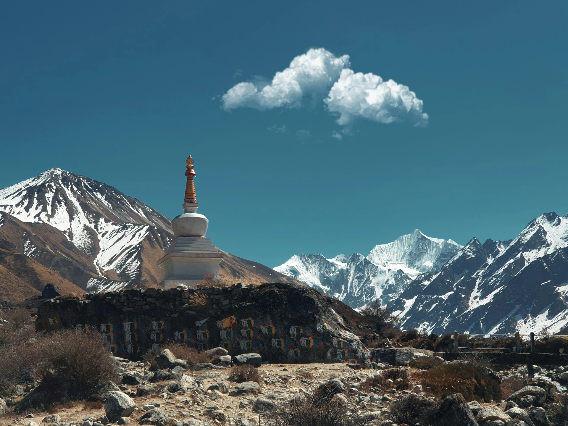
The last hour is the section people find hardest to walk through. You pass the debris field left by the 2015 avalanche, a grey expanse of rock and rubble that buried the old village, and then the memorial, a long wall of carved mani stones with names on it.
The village you sleep in was rebuilt above and to the side of the runout path, on ground the community chose after the survey work. The lodges are new, solid and much warmer than the old ones. They are run by families who lost people here and came back. Your guide will tell you the story if you ask, and will not push it on you if you do not.
Oxygen saturation and pulse readings start this evening and are taken daily from now on.
Duration:
5 to 6 hrs trek, 11 km
Accomodation:
Teahouse lodge, Langtang Village
A deliberately short day gaining 440 m. The trail crosses open yak pasture past mani walls, prayer wheels turned by the stream, and the small settlement of Mundu.
Kyanjin Gompa is the top of the valley and a genuinely striking place to arrive: a monastery, a scatter of lodges and a cheese factory set up with Swiss help in the 1950s, ringed by Langtang Lirung, Kimshung and Yala Peak, with the Lirung glacier hanging above.
Arriving before lunch is intentional. The afternoon is for a slow walk up towards the glacier viewpoint, buying a wedge of yak cheese, and letting your body get used to 3,870 m before tomorrow’s climb.
Duration:
3 to 4 hrs trek, 7 km
Accomodation:
Teahouse lodge, Kyanjin Gompa
Climb high, sleep low. The path goes straight up the slope behind the lodges, and it is steep from the first step. Kyanjin Ri has two tops: a lower one at about 4,350 m reached in an hour and a half, and the true summit at about 4,773 m another hour and a half above it. Plenty of operators quote the lower figure and call it the summit. They are two different places, and the view from the upper one is considerably better.
From the top you look down the whole Langtang valley with Langtang Lirung, Dorje Lakpa, Gangchenpo and the Tibetan border peaks around you.
If the group is strong and the weather is clear, the alternative is Tsergo Ri at 4,984 m, a longer and harder day of seven to eight hours. Your guide decides on the morning based on how everyone slept and on the oximeter readings, not on who wants it most.
Either way this is the highest you sleep before the pass and the work you do today is what makes Laurebina La manageable a week from now.
Duration:
5 to 6 hrs hike, 7 km
Accomodation:
Teahouse lodge, Kyanjin Gompa
A long descent, retracing the valley through Mundu, Langtang Village and Ghoda Tabela and down into the forest. Losing 1,400 m in a day is hard on knees and this is the day poles earn their place in your bag.
The valley reads completely differently walking west. You spend the morning looking down it rather than up at it, and the light is behind you instead of in your face.
Everyone eats properly tonight. Appetite comes back the moment you drop below 3,000 m and the dal bhat at Lama Hotel disappears fast.
Duration:
6 to 7 hrs trek, 18 km
Accomodation:
Teahouse lodge, Lama Hotel
Down to Bamboo, then across the river and onto a different hillside. Instead of returning to Syabrubesi we take the trail that climbs south-west through forest to Thulo Syabru, a Tamang village strung along a ridge with terraced fields dropping away below it.
This is a transition day and an easy one by the standards of this trek, about 600 m of descent and 400 m of climb. It also gets you onto the correct side of the valley for the Gosaikunda ridge, which is why we do it rather than walking back down to the road.
Thulo Syabru has a gompa at the top of the village, working water mills, and the last shops of any size until Helambu. Buy your chocolate here.
Duration:
5 to 6 hrs trek, 10 km
Accomodation:
Teahouse lodge, Thulo Syabru
Straight up, all day. This climbs 1,070 m through dense forest to Dursagang and then along the ridge to Sing Gompa, also called Chandanbari. Short in distance, relentless in gradient, and the biggest single sleeping gain of the trek.
We do it in one push because there is genuinely nowhere sensible to stop in between, and because the six nights you have just spent between 2,470 m and 3,870 m in Langtang have already done most of the acclimatisation work. That prior exposure is exactly why the traverse is safer in this direction than doing Gosaikunda cold from Dhunche.
Sing Gompa has an old Buddhist monastery and a yak cheese factory, and the ridge just above the lodges gives the first big southern view: Ganesh Himal, Manaslu, and on a clear evening the Annapurnas.
Duration:
5 to 6 hrs trek, 8 km
Accomodation:
Teahouse lodge, Sing Gompa
The shortest walking day of the trek and the one most itineraries leave out.
Nearly every operator goes Sing Gompa straight to Gosaikunda, which is 1,050 m of sleeping gain to 4,380 m the day before a 4,610 m pass. That is roughly double the accepted guideline and it is the reason so many people arrive at the lakes with a headache and cross the pass feeling terrible.
We split it. A gentle two to three hours along the ridge through juniper and rhododendron to the handful of lodges at Lauribina, then an afternoon doing very little. Walk up the ridge behind the lodges for an hour if you feel good, then come back down and sleep at 3,910 m.
It costs a day. It is the single most useful day on this itinerary.
Duration:
2 to 3 hrs trek, 4 km
Accomodation:
Teahouse lodge, Lauribina
A 470 m gain on open ground above the tree line, with the Himalaya laid out behind you the whole way. You pass Cholangpati and Buddha Mandir, then the first two lakes appear: Saraswati Kunda and Bhairav Kunda, small and dark, before the trail turns a corner and Gosaikunda itself opens up below the ridge.
The lakes sit in a bare rock basin with no trees and nothing soft anywhere. It is one of the more austere places in Nepal and, in the right light, one of the best.
Afternoon is free and deliberately unstructured. Most people walk the northern shore to the shrine and the rock said to be Shiva’s, or go up towards the pass for half an hour to see what tomorrow looks like. Do not swim. The lake is sacred, it is 4,380 m, and the water is a couple of degrees above freezing.
Your guide checks everyone’s oxygen saturation this evening and talks to the lodge owners and to anyone who crossed from the Helambu side today. The decision about tomorrow gets made tonight.
Duration:
3 to 4 hrs trek, 6 km
Accomodation:
Teahouse lodge, Gosaikunda
The hardest day, and the one everything else has been arranged around.
We leave between 5.30am and 6am. The climb from the lakes to the pass is 230 m and takes about ninety minutes over rock and, most of the year, some snow. Laurebina La at 4,610 m is a broad saddle with prayer flags, Langtang Lirung and Dorje Lakpa behind you and the Helambu ridges falling away in front. Wind is normal up there. Nobody lingers long.
Then the part people are not warned about: a 400 m descent on loose rock and old snow that is awkward rather than dangerous, followed by four more hours of relentless up-and-down across the Phedi basin to Ghopte. It never settles into a rhythm. Total descent for the day is around 1,170 m and most people arrive tired in a way they were not expecting.
Ghopte is two or three basic lodges tucked into a boulder field. Cold, simple, and a very welcome sight.
If the pass is not safe, we do not cross it. Fresh snow, whiteout, or a group that is not moving well all mean the same answer: back down to Sing Gompa and Dhunche and out by road. That decision belongs to your guide, it is made the night before, and nobody is talked into anything at 4,600 m.
Duration:
7 to 8 hrs trek, 15 km
Accomodation:
Teahouse lodge, Ghopte
An hour and a half of climbing to Tharepati at 3,690 m, high on an open ridge with the Jugal Himal and Dorje Lakpa to the east and, in clear weather, Everest and Gauri Shankar visible far to the east.
Tharepati is where the Helambu trails fork. West down the ridge goes to Kutumsang at 2,470 m, then Chisapani at 2,215 m, then Sundarijal on the Kathmandu valley rim, which is an hour from the city. East drops into the Melamchi valley and the Hyolmo villages. We go east.
The descent to Melamchi Gaon is 1,160 m through rhododendron and fir, steep in places and beautiful throughout. Melamchi Gaon is the first Hyolmo village: stone houses, a large gompa, apple and walnut trees, and a language that is closer to Tibetan than to the Tamang you have been hearing for ten days.
The village was badly damaged in 2015 and has been rebuilt. Look for the earthquake-resistant construction in the newer houses, which is the same approach used at Langtang.
Duration:
6 to 7 hrs trek, 14 km
Accomodation:
Teahouse lodge, Melamchi Gaon
Down 700 m to the Melamchi Khola, across the bridge, and back up 800 m the other side. It looks trivial on the map and it is not. This is the last real climb of the trek.
Tarkeghyang is the largest Hyolmo village in Helambu and the reason to have come this way. The gompa dates back several centuries in its foundation and the village keeps its own calendar of festivals. Houses are large, stone-built, with carved wooden windows and long balconies for drying grain.
Hyolmo people trace their ancestry to Kyirong in Tibet and are officially recognised as a distinct group in Nepal, not a subset of the Sherpa or the Tamang. You will hear both used loosely on other websites. It is worth getting right, and locally it matters.
Warm, low, green, and the first evening in a fortnight where you sit outside after dinner.
Duration:
5 to 6 hrs trek, 10 km
Accomodation:
Teahouse lodge, Tarkeghyang
An easy contouring walk along the hillside, barely any net height change, mostly in pine and rhododendron with the Jugal Himal on your left and terraced fields dropping to the valley floor on your right.
You pass through several small Hyolmo settlements and a lot of apple orchards. Sermathang is known for them, and in October you can buy apples straight from the tree.
Sermathang has a large gompa and a view that runs from Dorje Lakpa across to the hills above Kathmandu. A dirt road now reaches the village, which has made life easier for the people who live here and slightly diluted the walk. That is the honest trade and it is happening across Nepal.
Duration:
4 to 5 hrs trek, 12 km
Accomodation:
Teahouse lodge, Sermathang
A long steady descent of 1,720 m through terraced farmland and villages, much of it on or beside the dirt road. Rice paddies, buffalo, children walking to school. Hot by mid-morning, because you are down at subtropical altitude for the first time in two weeks.
Melamchi Pul Bazaar at 870 m is the lowest point of the trip and the end of the walking. From there it is three to four hours by road to Kathmandu, arriving late afternoon.
If you would rather cut the walk short, the vehicle can meet the group at Sermathang instead. Some groups do, particularly in May when it is hot. Say so the night before and we arrange it.
Celebration dinner at a Nepali restaurant in the evening, and trip completion certificates.
Duration:
4 to 5 hrs trek, 13 km, then 3 to 4 hrs drive
Accomodation:
3-star hotel, Kathmandu
Transfer to Tribhuvan International Airport about three hours before your flight.
If you have a spare day, Boudhanath is the right place to spend it after this particular trek. Much of the Hyolmo and Tamang Buddhism you have been walking through for two weeks has a presence there, and it makes more sense at the end than it would have at the beginning.
We can also arrange onward travel to Pokhara, Chitwan or Bhaktapur.
Duration:
Transfer 30 to 45 min
Accomodation:
Departure day
Trips Include
Everything below sits inside the trek price. Quantities are stated because vague inclusion lists are where trekking budgets quietly fall apart.
- Airport transfers on arrival and departure in Kathmandu, in a private vehicle
- 2 nights in a 3-star Kathmandu hotel on twin-share, with breakfast (single supplement available)
- 14 nights in teahouse lodges on twin-share along the trail
- All meals on trek: 15 breakfasts, 14 lunches and 14 dinners, with tea or coffee at every meal
- Fresh seasonal fruit after dinner each evening on the trail
- Celebration dinner at a Nepali restaurant in Kathmandu on your return
- Purified drinking water throughout the trek, so you never need to buy bottled water
- Private vehicle Kathmandu to Syabrubesi (7 to 8 hours) and Melamchi Pul Bazaar to Kathmandu (3 to 4 hours). No domestic flights are needed on this trek
- Licensed, English-speaking trekking guide trained in wilderness first aid, with a second guide for groups of 7 or more
- One porter per two trekkers, carrying up to 12 kg each
- All guide and porter wages, meals, accommodation, equipment, insurance and medical cover
- Langtang National Park entry permit (NPR 3,000 for foreign nationals, NPR 1,500 for SAARC nationals)
- TIMS card (NPR 1,000 for foreign nationals booking through a registered agency). Unlike the Everest region, Langtang still requires a TIMS card
- Shivapuri Nagarjun National Park entry fee, charged only if weather forces us onto the Chisapani exit route
- Comprehensive first aid kit carried by your guide, including a pulse oximeter used at the daily altitude checks
- Microspikes loaned for the Laurebina La crossing on departures where the pass is holding snow
- Everest Women Treks duffel bag, trekking map, sun hat and buff, yours to keep
- Trip completion certificate
- All government taxes, VAT and company administrative costs
Guide and porter wages, insurance, food, lodging and equipment are paid by us and already inside the price. You are never asked to top up staff costs on the trail.
Trips Exclude
These sit outside the package. Budget roughly USD 250 to 400 for seventeen days. Langtang lodge charges run a little below Everest region prices, but the Gosaikunda ridge is the exception: everything at Lauribina and Gosaikunda is carried up by porter or mule, and it is priced accordingly.
- International flights to and from Kathmandu
- Nepal entry visa: USD 30 for 15 days, USD 50 for 30 days, USD 125 for 90 days, obtainable on arrival at Kathmandu airport
- Lunch and dinner in Kathmandu, other than the included celebration dinner
- Travel insurance, which must cover helicopter evacuation and medical treatment to at least 5,000 m
- Bottled or boiled water, soft drinks, alcohol and hot chocolate on the trail
- Hot showers, device charging, wifi and heating charges at lodges. Budget USD 2 to 6 per item, higher at Lauribina and Gosaikunda
- Personal trekking clothing and equipment
- Sleeping bag and down jacket if you rent rather than bring your own, about USD 35 each for the trek
- Tips for your guide, porters and driver, customarily 10 to 15% of the trip cost, given as a group at the end
- Extra nights in Kathmandu if you finish early, for example if the pass is closed and we exit via Dhunche
- Emergency evacuation costs, which your insurer reimburses
- Laundry, phone calls, SIM cards and any personal expenses
- Anything not listed under what is included
Travel insurance covering helicopter evacuation and medical treatment to at least 5,000 m is required. Langtang is close to Kathmandu, which helps, but the stretch between Gosaikunda and Tharepati has no road, no lodge for seven hours and patchy phone signal. That is the part your policy needs to cover.
Packaging Lists
The three things that actually matter here
Boots with real grip. The descent from Laurebina La is loose rock over hard-packed snow for the first hour. Worn-smooth soles are the single most common cause of falls on this trek. Broken in over at least 50 km before you fly.
Microspikes or instep crampons. Not needed every departure, but needed on plenty of them. October, November, March and April all see snow on the pass. A pair weighs 400 g and costs about USD 20 in Kathmandu. Buy them and hope you carry them home unused.
A sleeping bag rated to minus 15C comfort. Lauribina and Gosaikunda are cold, the lodges are unheated apart from the dining room, and blankets are thin. Comfort rating, not extreme rating.
Worth adding for this route
Trekking poles, both of them, for the pass descent and for the 3,500 m of downhill in the last four days. Category 3 or 4 sunglasses, because snow on the Gosaikunda basin throws serious glare. A 20,000 mAh power bank: there is no mains power at Ghopte and charging is expensive from Sing Gompa onwards.
Upper body
2 merino or synthetic base layers, 1 fleece, 1 light down or synthetic mid-layer, 1 waterproof windproof shell, 1 warm down jacket (rentable in Kathmandu for about USD 35).
Lower body
2 pairs trekking trousers, 1 pair thermal leggings, waterproof over-trousers, 4 to 5 pairs underwear, 4 pairs trekking socks plus a thick pair kept dry for sleeping.
Head, hands and feet
Sun hat, warm beanie, buff, category 3 or 4 sunglasses, liner gloves, insulated outer gloves, boots, camp shoes.
For women
Bring enough menstrual supplies for the full seventeen days plus a few spare, since nothing reliable is sold past Syabrubesi and altitude often shifts cycle timing. Sealable opaque bags for used products, which you carry out.
Health and documents
Personal first aid kit, blister plasters, rehydration salts, prescription medication in original packaging, sunscreen SPF 50, SPF lip balm, headlamp with spare batteries, passport, four passport photographs, insurance certificate, and Nepali rupees in small notes.
Bags
One duffel of up to 12 kg carried by your porter (we provide the duffel), plus a 25 to 35 litre daypack you carry yourself. No flight weight limit on this trek, which is one small mercy of travelling by road.
Trips Altitude
Trips FAQs
The questions we get asked about this trek, starting with the one that decides it: whether you want this or the shorter Langtang Valley trek.
They share the first five days and then they are different treks.
Langtang Valley goes up one valley to Kyanjin Gompa and comes back down the same trail. Around ten days door to door, highest sleeping altitude 3,870 m, no pass, moderate grade. It suits people who are short on time, new to altitude, or want the Langtang valley without a committing high crossing.
Langtang Helambu uses that valley as the first half. You then climb a separate ridge to Gosaikunda at 4,380 m, cross Laurebina La at 4,610 m and walk out through Helambu. Seventeen days, three distinct regions, and a strenuous grade because of the pass.
Rule of thumb: if crossing a 4,610 m pass with a loose 400 m descent on the far side sounds like the good part, book this one. If it sounds like the part you would rather skip, book the valley trek. Both are good treks. Only one of them has a day you can fail.
Strenuous, and we grade it that way on purpose while some operators call the same route moderate.
What makes it strenuous is not any single altitude figure. It is the cumulative work: fourteen consecutive walking days, roughly 6,000 m of total ascent and rather more descent, one 1,070 m climb in a single day to Sing Gompa, and a seven to eight hour pass day with no bail-out point in the middle.
You need to be able to walk six hours on consecutive days over rough ground and get up and do it again. Previous high-altitude experience is not required. Reasonable hill fitness is.
The three hardest days, in order: Day 12 over the pass, Day 9 up to Sing Gompa, Day 7 down to Lama Hotel. The last of those catches people out because it is all downhill.
We turn around, and we do it without drama.
The pass can be blocked by fresh snow, by a whiteout, or by wind strong enough to make the ridge unpleasant. It holds snow into early May and again from late November, and heavy falls happen in October and March too.
Your guide makes the call at Gosaikunda the evening before, after talking to the lodge owners and to anyone who has come across from Ghopte that day. If the answer is no, we descend to Sing Gompa and Dhunche and drive back to Kathmandu, which takes two days. You will have completed the Langtang valley, Kyanjin Ri and Gosaikunda, which is the bulk of the trek.
Two things we do not do. We do not attempt the pass in poor conditions because a group has flights booked. And we do not charge you extra for the alternative exit, though you may end up paying for an extra Kathmandu hotel night if you finish early.
We carry microspikes for the group on departures where the pass is likely to be holding snow, and they are included.
Two permits, both included: the Langtang National Park entry permit at NPR 3,000 for foreign nationals and NPR 1,500 for SAARC nationals, and a TIMS card at NPR 1,000 when you book through a registered agency, or NPR 2,000 independently.
Langtang is not Everest on this point, and the confusion is common. TIMS was abolished in the Everest region and replaced by a local municipality permit. In Langtang the TIMS card is still required and checked, at Dhunche and again at Syabrubesi. Anyone telling you TIMS is dead nationwide is repeating Everest-specific news.
If weather pushes us onto the Chisapani exit, there is a Shivapuri Nagarjun National Park fee as well. We include that too rather than surprising you with it on the last day.
Bring your passport and four passport photographs. We arrange everything in Kathmandu.
This is the question worth asking about any Gosaikunda itinerary, because most of them have the same flaw.
The standard version goes Thulo Syabru 2,150 m to Sing Gompa 3,330 m to Gosaikunda 4,380 m on consecutive days. That is a 1,180 m sleeping gain followed by a 1,050 m sleeping gain, ending at 4,380 m the night before a 4,610 m pass. The usual guideline above 3,000 m is around 500 m a day.
We break the second one with a night at Lauribina, 3,910 m, so the gains become 580 m and then 470 m. We also run the traverse in this direction, Langtang first, so you arrive at the Gosaikunda climb having already slept two nights at 3,870 m and climbed to 4,773 m. Doing Gosaikunda first, from Dhunche, throws you at 4,380 m with no prior exposure at all.
Your guide records oxygen saturation and resting pulse every evening from Day 4, so what gets looked at is the trend across days rather than one number.
Yes, and it is the most underrated thing about Langtang.
Everest treks depend on Lukla, where flights are cancelled routinely for cloud and where losing two days at each end is a normal outcome. That is why those itineraries tell you to keep spare days. Annapurna has Jomsom with a similar problem.
Here you drive. Seven to eight hours to Syabrubesi at the start, three to four hours home from Melamchi Pul Bazaar at the end. The road can be delayed by a landslide in the monsoon, but it is measured in hours, not days, and it operates in weather that grounds aircraft.
What you save: two buffer days, one domestic flight cost at each end, the 15 kg flight weight limit, and the specific anxiety of sitting in a Lukla departure lounge watching your international connection get closer. What you pay: a genuinely tedious drive on day two.
On 25 April 2015 the Gorkha earthquake broke a huge mass of ice and rock off the flank of Langtang Lirung. It fell around 1,500 m and struck Langtang village as an air blast and debris avalanche. More than 300 people died there: villagers, trekkers and army personnel among them. One building was left standing.
The village was rebuilt between 2016 and 2018 on higher ground outside the runout path, with the site chosen after geological survey work, and the trail through the valley reopened in 2017. Construction uses earthquake-resistant methods. There is a memorial of carved mani stones on the approach.
Is it safe? As safe as any Himalayan valley, which is not the same as absolutely safe. The specific slope that failed is understood and the new village is not below it.
The part that matters practically: trekking income paid for much of the rebuild and still funds the school and health post. Walking through and spending money in local lodges is directly useful. Ask before photographing the memorial, and if a lodge owner wants to talk about 2015, listen. If they do not, leave it.
Gosaikunda is one of the more significant high-altitude pilgrimage sites in Nepal and it is usually reduced on trekking websites to the phrase ‘holy lake’, which explains nothing.
In Hindu tradition the lake was created by Shiva. After drinking the poison churned from the cosmic ocean, he struck the mountainside with his trident to release water and cool his burning throat, and the lakes formed. A rock formation in the water is identified as Shiva. The Trishuli river, which you drive alongside on the way to Syabrubesi, is said to rise here. Trishuli means trident.
The lakes are sacred to Buddhists too, and to the Tamang communities of the surrounding hills, who hold their own observances there.
Janai Purnima falls on the full moon of the Nepali month of Shrawan, usually in August. Thousands of pilgrims walk up from Dhunche and Sundarijal, many of them older, many barefoot, to bathe in the lake and change the sacred thread worn across the body. Jhankris, traditional shamans, come in ritual dress and drum through the night.
You can trek then. Understand what you are getting: lodges full and floors sold as sleeping space, and monsoon cloud that usually hides the mountains entirely. Tell us months in advance.
Because it is the other half of the point.
Everything before the pass is Tamang: the villages, the food, the gompas, the language. Cross Laurebina La and drop 2,000 m and you are among Hyolmo people, who trace their ancestry to Kyirong in Tibet and are recognised as a distinct group in Nepal. Different language, different architecture, different festivals. The gompas at Melamchi Gaon and Tarkeghyang are larger and older-feeling than anything in the Langtang valley.
It is also physically a relief. You are between 2,500 m and 2,700 m, it is green, there are apple orchards, pine forest and buckwheat fields, and after two weeks of cold rock you sit outside after dinner in a t-shirt.
If all you want is high mountains, the trek peaks at Day 12 and the rest is a walk out. If you are interested in why two valleys ninety kilometres apart are completely different places, this is the section you came for.
Straight answers, because a badly matched booking is worse for you than a lost sale is for us.
Do not book if you have under two weeks in Nepal. Seventeen days plus buffer needs three weeks realistically. Do the Langtang Valley trek instead.
Do not book if a 4,610 m pass with loose ground is the part you are dreading. The pass is not optional and there is no vehicle access anywhere near it.
Do not book if you cannot manage fourteen consecutive walking days. There is one rest day in seventeen. Fitness matters here more than altitude tolerance does.
Do not book for June to August unless you are specifically coming for Janai Purnima. Leeches in the Langtang forest, cloud over everything, and slippery ground on the pass descent.
Think hard if you need reliable connectivity. There is effectively none between Lauribina and Melamchi Gaon, which is four days.
Book it if you want three regions in one walk, no flights, and a pass day that means something.
October and November are the best conditions of the year. Clear air, the Ganesh and Manaslu views from the Gosaikunda ridge at their sharpest, and the pass usually snow-free into mid-November. Coldest nights at Gosaikunda run to around minus 10C.
March to May gives rhododendron in flower in the Langtang gorge and through Helambu, which is genuinely worth seeing in April. The pass often holds snow into early May, so microspikes matter more in spring than in autumn. Afternoon haze builds from late April.
December to February is cold and quiet, and lodges at Lauribina, Gosaikunda and Ghopte close or run skeleton service. The pass frequently closes for days at a time. We only run winter departures as private trips with a contingency plan agreed in advance.
June to August is monsoon. Leeches below 3,000 m, no views, and a slippery pass descent. The one reason to come is Janai Purnima.
Comfortable at both ends, basic in the middle.
The Langtang valley rebuilt after 2015, so lodges at Langtang village and Kyanjin Gompa are newer and warmer than most of what you find at similar altitude elsewhere. Helambu is low, green and easy. In between, Lauribina, Gosaikunda and especially Ghopte are as simple as Nepali teahouses get: a plywood twin room, a thin mattress, a shared toilet outside, and one stove in the dining room lit at dusk.
Ghopte is the roughest night of the trek. Two or three lodges, no mains electricity, and cold. Everyone gets through it and everyone remembers it.
Budget USD 250 to 400 beyond the trek price for seventeen days: Kathmandu meals, hot showers at USD 2 to 6, charging at USD 2 to 5 per device, wifi where it exists, snacks and tips. Carry Nepali rupees in small notes from Kathmandu. There is an ATM in Dhunche and nothing usable after that until you are back near the road at Melamchi Pul.
Tipping is customary at 10 to 15% of trip cost, pooled by the group and given on the last evening.
A policy that explicitly covers trekking to at least 5,000 m and includes helicopter evacuation and medical repatriation. Standard travel insurance usually caps altitude cover well below that and many policies exclude helicopter rescue outright.
Read the altitude clause in the wording rather than trusting a summary page, and send us the certificate before you travel. We check it at the Kathmandu briefing.
The section that makes this non-negotiable is Day 12. Between Gosaikunda and Ghopte there is no road, no lodge for seven hours and unreliable phone signal. Helicopters can reach both the lakes and the Ghopte basin in reasonable weather, which is a genuine advantage of being this close to Kathmandu, but somebody has to be paying for it.
Yes. Solo travellers make up a large share of every departure we run, and you are with a licensed guide from Kathmandu to Kathmandu.
Twin-share rooms are allocated with someone of the same sex unless you request and pay for a single. Singles are limited at Lauribina, Gosaikunda and Ghopte, where there are only a few lodges and rooms are allocated by whoever arrives.
The Gosaikunda ridge and the Ghopte basin are quiet, which most people find is the appeal. On the pass day the group walks together rather than spread out, which is standard practice for us on any high crossing.
Lodge doors on this route often have no lock. A small travel lock is worth 100 g in your bag, and a sarong to change under is worth a bit less.
Good to Know
The questions we get asked about this trek, starting with the one that decides it: whether you want this or the shorter Langtang Valley trek.
Here is the day hour by hour, because it is the one worth knowing in advance.
5.30am to 6am, leave Gosaikunda. Head torches on. It is cold, usually well below freezing, with wind coming over the saddle.
First 90 minutes, 230 m up. The trail climbs above the lake over rock, boulders and, most of the year, patches of old snow. Not steep by Himalayan standards, but the footing is uneven and it is the highest you have been.
Laurebina La, 4,610 m. A broad saddle with prayer flags. Langtang Lirung and Dorje Lakpa behind, the ridges of Helambu ahead and, in clear autumn weather, Everest and Gauri Shankar far to the east. Fifteen minutes is usually enough. It is windy and nobody warms up standing still.
The descent, about 400 m. The part nobody warns you about. Loose rock over hard snow, no proper path in places, and steep enough that trekking poles stop being optional. Take it slowly. Most falls on this trek happen here.
Then four more hours to Ghopte. The Phedi basin is a long series of ascents and descents through boulders and stunted rhododendron. It never flows and it is tiring in a way the numbers do not capture. You will be glad to see the lodges.
Total for the day: 15 km, roughly 400 m up and 1,170 m down, seven to eight hours moving. There is no lodge, no road and no shortcut between Gosaikunda and Ghopte. That is why the decision is made the night before.
There are more than 100 lakes in the Gosaikunda basin and the wetland is listed as a Ramsar site. Four matter to trekkers: Saraswati Kunda and Bhairav Kunda on the way in, Gosaikunda itself, and Surya Kunda a little beyond.
Gosaikunda sits at 4,380 m and freezes solid from about December to May, when the surface is walkable ice. In October it is deep blue and quite still.
The Hindu account is that Shiva drank the poison produced by the churning of the ocean, and struck the mountain with his trident to release cold water. The lakes are the result, and the rock in the middle of the water is identified with him. The Trishuli, which you follow by road on Day 2, is said to flow from here.
Practical etiquette: do not swim, do not wash in the lake, do not throw anything in, walk clockwise round the shrine, and ask before photographing anyone praying. Lodge owners raise the swimming issue more than any other. It causes real offence.
The three pilgrim routes converge here: from Dhunche, from Sundarijal through Helambu, and over the pass. At Janai Purnima in August all three are busy at once.
You sleep four nights above 3,800 m and the highest sleeping altitude is Gosaikunda at 4,380 m. The highest point you cross is Laurebina La at 4,610 m, and the highest you reach at all is Kyanjin Ri at about 4,773 m on a day when you come back down to sleep at 3,870 m.
Two things make this profile work. First, the direction: Langtang first means you climb the Gosaikunda ridge already acclimatised, rather than going up cold from Dhunche. Second, the extra night at Lauribina at 3,910 m, which splits a 1,050 m sleeping gain into 580 m and 470 m.
The remaining risk point is Day 9 to Sing Gompa, which gains 1,070 m. It is unavoidable because there is nowhere to stop, and it is tolerable because you have spent the previous week between 2,470 m and 3,870 m.
What we ask from you: 3 to 4 litres of water a day, walk slower than feels natural, eat when you do not feel like it, no alcohol above Sing Gompa, and report a headache the first time you notice it rather than the third. Your guide records oxygen saturation and resting pulse each evening from Day 4.
Descent is fast here. From Gosaikunda you can be at Sing Gompa, 1,050 m lower, in three hours, and at Dhunche and a road the same day. Being close to Kathmandu is a genuine safety margin on this trek.
Diamox helps some people. Talk to your own doctor and trial it at home first, not at 4,000 m.
The Gorkha earthquake of 25 April 2015 killed roughly 9,000 people across Nepal. Langtang village was the single worst-affected settlement in the country relative to its size.
The shaking sheared an enormous mass of hanging glacier and rock off Langtang Lirung. It fell around 1,500 m and hit the valley floor with an air blast strong enough to flatten forest on the opposite slope before the debris arrived. Over 300 people died in the village: residents, trekkers, guides, porters and army personnel. Whole families were lost. One building survived.
Survivors spent months in Kathmandu, then began returning. The new village was built above the debris field on ground selected after survey work, using earthquake-resistant construction. The trail reopened in 2017 and lodges have been operating since.
You will walk past the debris field, which is still bare grey rock, and past a memorial wall of carved mani stones. Many trekkers find that stretch of the day heavier going than the climb.
What we ask of our groups: spend money locally rather than carrying everything in, ask before photographing the memorial, and do not press people for their story. Some will want to tell it and some will not. Trekking income funded a large part of the rebuild and continues to pay for the school and the health post, so being here is genuinely useful. It just wants doing with some care.
Helambu runs from around Tharepati south towards the Kathmandu valley, and its people are Hyolmo, sometimes written Yolmo. They are a distinct group, officially recognised in Nepal, with ancestry traced to Kyirong in Tibet and their own Tibeto-Burman language. They are not Sherpa and they are not Tamang, although plenty of trekking websites call them one or the other.
Practically, what you notice: bigger stone houses with carved window frames and wide balconies, larger gompas, apple and walnut orchards, and Nyingma Buddhism with its own local festival calendar. Tarkeghyang and Melamchi Gaon are the main villages and both have gompas worth half an hour.
Helambu sits between 2,500 m and 2,700 m, which means green, warm and easy walking after two weeks of rock. It also means the region is close enough to Kathmandu that many families have members working there, and roads are arriving village by village. A dirt road now reaches Sermathang.
Melamchi Gaon and Tarkeghyang were both badly hit in 2015 and both have been rebuilt. The recovery here is less discussed than Langtang’s but it happened at the same time and for the same reason.
Every departure runs with a licensed, English-speaking guide trained in wilderness first aid. Groups of seven or more carry a second guide, which matters more on this trek than most: on the pass day, if one person has to turn back, the group has to split, and splitting needs two qualified people.
Porters carry up to 24 kg shared between two trekkers. All staff are insured, properly equipped with boots, jackets and eyewear, paid above the government minimum, and fed and accommodated at our cost.
The Gosaikunda to Ghopte section is the reason porter equipment is not negotiable. It is the highest, coldest and most exposed ground on the route, there is no shelter for seven hours, and porters historically have been the people most at risk on crossings like it.
Your guide carries a first aid kit with a pulse oximeter, a local SIM, and a group contact schedule with our Kathmandu office. Signal is unreliable between Lauribina and Melamchi Gaon and the office knows to expect gaps there rather than to assume the worst.
Carry Nepali rupees in small notes from Kathmandu. There is an ATM in Dhunche on the drive in, and after that nothing reliable until you are near the road again at Melamchi Pul. Cards are not accepted on the trail.
Expect to pay for what is free in the city: hot showers USD 2 to 6, device charging USD 2 to 5 per device, wifi USD 2 to 5 a day where it exists. Prices climb with altitude, and Lauribina and Gosaikunda are the most expensive stops because everything arrives by porter or mule.
Ghopte has no mains power at all. Charge everything at Gosaikunda the evening before the pass, and carry a 20,000 mAh power bank. Cold flattens batteries, so sleep with your phone and power bank inside the sleeping bag.
Mobile coverage is patchy in the Langtang gorge, reasonable at Kyanjin Gompa, and effectively absent from Lauribina until you drop into Melamchi Gaon. That is four days. Tell people at home before you leave.
Book two months ahead for October and April. Lauribina, Gosaikunda and Ghopte between them have perhaps a dozen lodges, and in peak autumn they fill.
A 20% deposit confirms your place, with the balance due in Kathmandu before you drive north. We can hold a provisional booking for seven days at no cost.
Cancel more than 30 days out and the deposit is refundable less bank charges. Inside 30 days it is retained but transferable to another departure within 12 months.
If we cancel a departure, which happens only for safety or if a group does not reach minimum numbers, you choose between a full refund and a transfer.
Turning back at the pass is not a cancellation and is not refundable. Permits, lodges and staff are booked and paid for the full seventeen days. What we do instead is run the alternative exit at no extra cost, so you still get a complete trek out of it.
Book two months ahead for October and April. Lodges at Lauribina, Gosaikunda and Ghopte are few and small, and in October the Gosaikunda ridge fills faster than the Langtang valley does.
A 20% deposit holds your place, with the balance due in Kathmandu before you drive north. We can hold a provisional booking for seven days at no cost.
After booking you get a pre-departure pack: a ten-week training plan, a kit list you can tick off, and a short note on which insurance policies genuinely cover helicopter evacuation above 4,500 m.
You do not need spare days for flights, and that is unusual. Both ends of this trek are road journeys. The Pasang Lhamu Highway to Syabrubesi can close after heavy rain or a landslide, mostly in the monsoon, but a road delay is measured in hours rather than days. One buffer day before your international flight is plenty.
Tell us early if you want to be at Gosaikunda for Janai Purnima. The festival falls on the August full moon and brings thousands of pilgrims up to the lakes. It is remarkable and it is also chaotic, with lodges full and floors sold as beds. It needs planning months out, and August weather means you will probably see very little of the mountains.